
Greenville safety
Greenville safety is a flood, storm, neighborhood, and route question
Greenville’s overall safety row is Not available. In the 2024 city rows, violent crime is 650 incidents per 100,000 and property crime is 3,481 incidents per 100,000. Keep the displayed year and scope beside those figures, and do not use them to call every Greenville address safe or unsafe.
The hazard rows show Moderate natural disaster risk, High flood risk, Low wildfire risk, High storm risk, Moderate heat risk, Low drought risk, and nine major disaster declarations since 2000. Check the exact property, drainage, ground level, shade, lighting, parking, emergency contacts, power needs, medication storage, and evening route before deciding how the address works.
The safety picture
Greenville’s city crime rows and county hazard rows describe different parts of the home decision and should be reviewed together without a single citywide label.
- Violent Crime
- 650 per 100k
- Property Crime
- 3,481 per 100k
Moderate
Moderate
The Reedy and nearby routes deserve weather planning
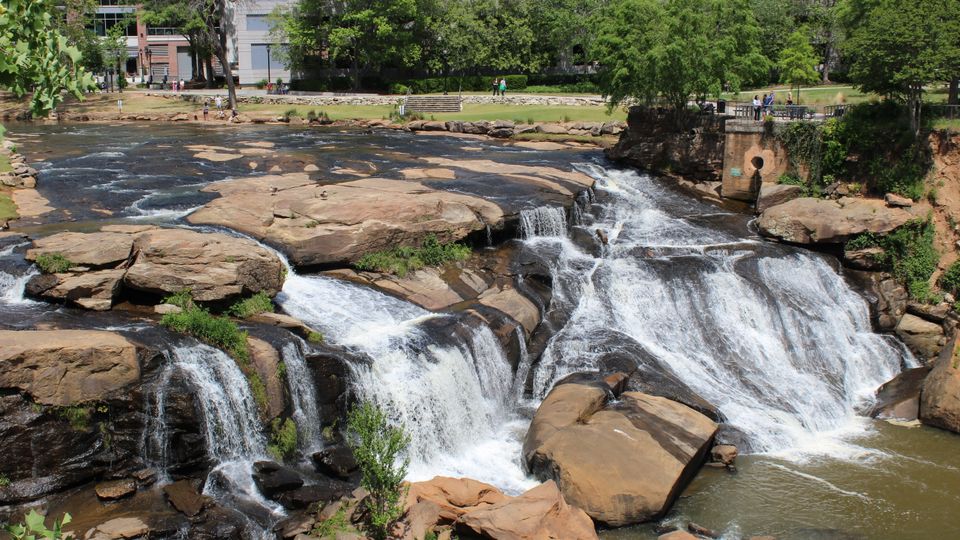
Falls Park and the Reedy are central to Greenville’s downtown identity, while the published hazard rows mark flood risk High and storm risk High. Keep outdoor places in the weekly plan, and also check weather, water, shade, crossings, and a way home when conditions change.
A destination close to downtown can still involve parking, traffic, stairs, a wet surface, or a longer return than the map suggests. The home search should include the route used after rain and after dark.
Day to day confidence
Lighting, crossings, parking, heat, rain, traffic, the final block home, and the route to care shape ordinary safety in Greenville.
- Major Disaster Declarations Since 2000
- 9
The last block home still matters
A care, grocery, arts, or transit trip does not end at the parking space or bus stop. Review lighting, crossings, traffic, pavement, heat exposure, umbrellas, mobility aids, and the distance from the drop off point to the door.
Greenlink and GAP add mobility tools, but service and route fit vary by address. Keep a second option for medication, weather, power, and the journey home.
Weather and natural risks
Review each risk in its own right before choosing a neighborhood or property.
- Natural Disaster Risk
- Moderate
- Flood Risk
- High
- Wildfire Risk
- Low
- Storm Risk
- High
- Heat Risk
- Moderate
- Drought Risk
- Low
Greenville in everyday life
Could Greenville work for you?
What may work well
- Greenville’s parks, Falls Park, Heritage Green, museums, arts, and Greenlink create several ways to stay connected to the city.
- Wildfire risk is Low and drought risk is Low in the published hazard rows.
- GAP paratransit offers an additional mobility route to investigate alongside fixed route Greenlink service.
- Published crime rows include their 2024 year, allowing the household to ask for more address specific information rather than relying on a vague label.
What to think about
- Overall safety is Not available, so the city page does not provide a single safety conclusion.
- Flood risk and storm risk are High, with nine major disaster declarations since 2000.
- The 650 violent crime and 3,481 property crime rows are city rows for 2024, not a description of every neighborhood or property.
- Heat, rain, lighting, parking, care travel, power, and the final block home all belong in the same route review.
Before choosing a Greenville address, check the local conditions
Review the property
Inspect drainage, ground level, roof, trees, windows, locks, lighting, parking, shade, stairs, and the route to the door.
Name the emergency contacts
Set alerts, family contacts, preferred care destination, pharmacy, transport options, power needs, medication storage, and a place to go if the home is not usable.
Plan storm and heat days
Keep water, medications, cooling, food, power, weather information, car supplies, and a route home ready for High flood and High storm conditions.
Review the route at different times
Look at the walk, parking, Greenlink or GAP stop, downtown crossings, Falls Park area, and final block in daylight, after dark, and when weather changes if possible.
Questions retirees ask
Is Greenville safe for retirees?
The published overall safety row is Not available, so Greenville should not be reduced to safe or unsafe. Review the 2024 city crime rows, High flood and storm risks, property conditions, evening routes, lighting, emergency preparation, and the exact neighborhood.
What do the Greenville crime rows show?
The published city rows show 650 violent crime incidents per 100,000 and 3,481 property crime incidents per 100,000 in 2024. Keep the year and scope with those figures, and ask for address or neighborhood information before deciding.
What hazards matter most in Greenville?
Natural disaster risk is Moderate, flood risk is High, wildfire risk is Low, storm risk is High, heat risk is Moderate, and drought risk is Low. There have been nine major disaster declarations since 2000 in the published row.
How should an older adult plan for storms?
Plan alerts, medications, power, cooling, water, food, family contacts, transport, the preferred hospital, pharmacy access, and a route home. Check the specific property’s drainage, roof, trees, ground level, and insurance.
Do Greenlink and GAP answer every safety or transport need?
Greenlink fixed route transit and GAP paratransit add options, but service, route coverage, weather, mobility, and the distance from the stop or drop off point to the home vary. Review the actual trips before relying on either service.
Greenville’s safety decision belongs to the exact home and route, with city crime rows, county hazard rows, weather preparation, and evening travel considered together. For Greenville’s home review, choose Save, Compare, or Find my fit.
Sources
Safety depends on the neighborhood, the places you go each day, transportation, and personal comfort.
Use official local sources and recent neighborhood-level context before choosing where to stay, rent, or buy.
- FBI Crime Data Explorer
Used for Violent Crime, Property Crime
Checked 2024-12-31
- Federal Emergency Management Agency National Risk Index
Used for Natural Disaster Risk, Flood Risk, Wildfire Risk, Storm Risk, Heat Risk, Drought Risk
- Federal Emergency Management Agency (OpenFEMA)
Used for Major Disaster Declarations Since 2000
Not yet available for this place: Overall Safety.
Partnerships never affect rankings, scores, methodology, or inclusion.
Partner with Retirement ListsResearch and writing byGrant Gibson
How this city research is made
Retirement Lists uses documented public sources and methods to research, review, and correct city information. Read our Editorial Policy.